Physical Address
Bankura, West Bengal 722142
Physical Address
Bankura, West Bengal 722142

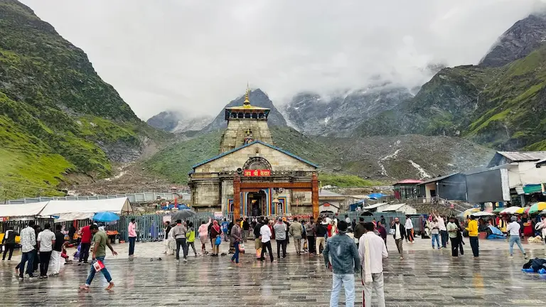
Many people think a 16-kilometer walk is just a long day on your feet. But the steep Himalayan mountains in Uttarakhand are different. Every year, thousands of pilgrims visit the Kedarnath Temple. They want to know the real Kedarnath Trek Difficulty Level. Travel blogs might call it an easy 16km trip, but the ground reality is much harder.
Here is what really happens on the mountain. We skip the guesswork and use real smartwatch distances. You will learn the right medical steps for altitude sickness, check actual ground costs, and find out how mobile networks work up there. We also show you the hidden travel problems you must fix before you even start walking.
Here is the exact math for your climb:
The Reality: Brutal leg work. Pushing 1,600 meters up in one day is exactly like climbing stairs for 10 hours.
Compare Kedarnath to other famous Indian trails you might know. This gives you a quick test of your fitness.
| Trek Name | Distance (One Way) | Elevation Gain | Overall Difficulty | How It Compares to Kedarnath |
| Vaishno Devi | 13 km | 700 meters | Easy to Moderate | Vaishno Devi has paved paths and sits low. Breathing is easy. Kedarnath is twice as steep with much less air. |
| Tungnath | 3.5 km | 600 meters | Moderate | Tungnath sits higher up, but you finish it in a few hours. Kedarnath makes your lungs work hard for 10 hours straight. |
| Valley of Flowers | 10 km | 400 meters | Moderate | Valley of Flowers has easy ups and downs. Kedarnath never flattens out—you just climb straight up the whole way. |
The real trouble starts before you even walk. Reaching the start line costs both money and energy. If you ignore these exact rules, guards will not even let you climb.
You cannot just arrive and start walking. The government requires Char Dham Yatra registration to give you a special Yatra QR code. Police will stop you and scan this code constantly on the mountain.
Where to register: Do it on the official site (registrationandtouristcare.uk.gov.in) or simply download the Tourist Care Uttarakhand app.
Police stop all cars at Sonprayag. But the climb actually starts 5 km away in Gaurikund. You have to take a shared taxi to bridge this gap. In busy months? That taxi line starts at 3:00 AM. Prepare to stand freezing for two hours just to get a seat.
Stop guessing the prices. Look at this exact price list so no one cheats you on the mountain:
| Transport Type | Estimated Cost (One-Way) | Important Rules & Ground Reality |
| Shared Taxi (Sonprayag to Gaurikund) | ₹50 to ₹80 per person | The drive is only 20 minutes. But prepare to stand in a long line for 1 to 2 hours just to get a seat. |
| Mule / Pony | ₹3,000 to ₹3,500 | Only buy tickets from official Gaurikund desks. They will not take anyone over 80-90 kg. |
| Dandi (Palanquin) | ₹8,000 to ₹10,000 | Four men carry you up. This is great for older people. The exact price shifts a little every season. |
| Kandi (Basket Carrier) | ₹1,500 to ₹2,500 | A man carries a basket on his back. Use this just for children or very thin adults. |
| Helicopter | ₹5,500 to ₹8,000 (Return) | Only use the real IRCTC HeliYatra website to book. You must weigh under 80kg, or you have to pay extra cash for every extra kilo. |
Forget about having internet the whole time. Huge mountains block the signals. Here is what actually works on the path:
| Telecom Operator | Gaurikund (Start) | Lincholi (Midway) | Kedarnath Base Camp (Top) |
| Jio | Good 4G | Drops a lot | Good 4G (new towers) |
| Airtel | Good 4G | Very weak or dead | Fair to Good 4G |
| BSNL | Excellent | Good | Excellent (Best network up here) |
| Vodafone Idea (Vi) | Poor | Dead | Dead |
Afternoon mountain weather brings very dangerous fog. Police know this, so they block the path at Gaurikund. You cannot start walking after 1:30 PM. Show up late? You will just have to sleep in Gaurikund and wait for morning.
This walk is hard because four things hit you all at once: gravity, low oxygen, rough paths, and wild weather.
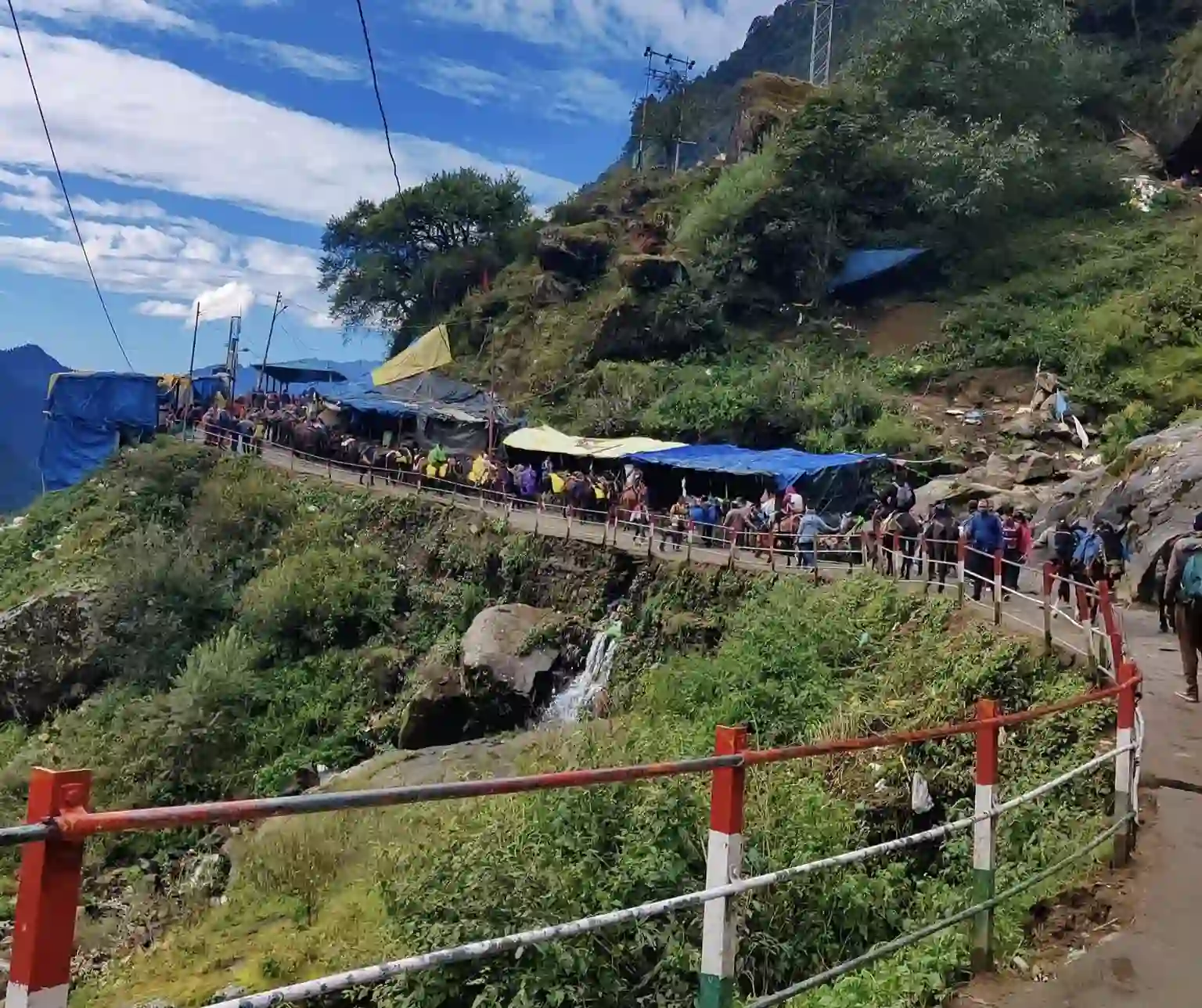
Normal hills go up and down. Kedarnath does not. It is just one massive uphill climb. You almost never get a flat spot to rest. Every single step forces you to push your whole body weight straight up against gravity.
Normal air down at sea level gives you 21% oxygen. But Kedarnath is 3,583 meters high. Up at the temple, you only get 13.5% oxygen. The air is extremely thin. This forces your heart to beat very fast just to keep your legs moving.
The weather completely changes your trip. Look at this list so you pack the right clothes:
| Travel Season | Avg. Temperature | Trail Conditions & Difficulty Level |
| May & June (Summer) | Day: 10°C to 15°C Night: 0°C to 5°C | The path is clear but packed with people. It is a moderate walk. Get ready to wait in long lines for mules. |
| July & August (Monsoon) | Day: 10°C to 12°C Night: 2°C to 6°C | Very dangerous. The mud makes everything super slippery. Landslides happen a lot. Only go if you are highly fit and know how to trek. |
| September & October (Autumn) | Day: 8°C to 12°C Night: -2°C to 3°C | Best walking weather with nice clear skies. But it gets cold really fast. Icy winds at the top make the final climb much harder. |
You must pace yourself. Here is the exact route, showing where to find the medical camps.
| Trek Stage | Distance | Est. Time | Difficulty | Ground Reality & Facilities |
| Stage 1: Gaurikund to Jungle Chatti | 4 km | 1.5 – 2 Hours | Easy-Moderate | Gradual uphill walk on a wide path. Has water points and basic toilets. |
| Stage 2: Jungle Chatti to Bheembali | 3 km | 1.5 Hours | Moderate | The path gets narrow. Has tea stalls and the first Medical Camp. |
| Stage 3: Bheembali to Rambara Bridge | 2 km | 1 Hour | Moderate-Hard | You cross the river here. Watch out for a huge mule traffic jam. Last main group of toilets. |
| Stage 4: Rambara to Chhoti & Badi Lincholi | 4 km | 2.5 – 3 Hours | Very Difficult | Very steep zig-zag climb. You cross 3,000 meters. Army Medical Post here has oxygen checks. |
| Stage 5: Badi Lincholi to Kedarnath Base | 3 km | 1.5 – 2 Hours | Hard | Flatter path, but very hard to breathe. Freezing cold wind. Shops and main Medical Camp at the base. |
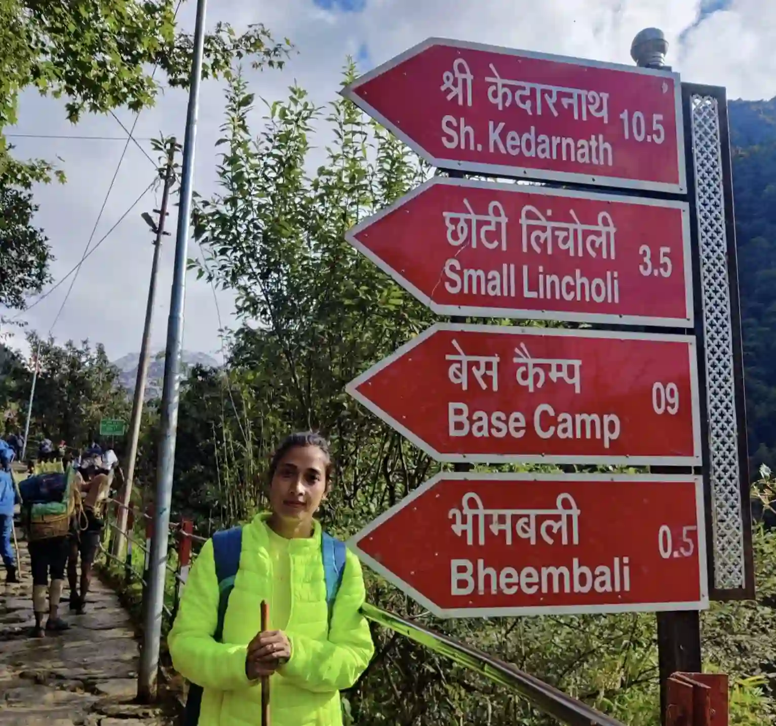
Finding a clean toilet is a big worry for female trekkers. The government built bio-toilets mostly near Jungle Chatti and Bheembali. But since thousands of people use them daily, they get dirty very fast.
Pack your own toilet paper, wet wipes, and hand sanitizer. Women should really bring a stand-and-pee device (pee-funnel). It lets you use the mountain washrooms without ever touching the dirty seats.
Medical Disclaimer: This advice comes from real trekking and basic first-aid. It is not professional medical advice. Always ask your doctor before taking high-altitude pills like Acetazolamide (Diamox).
Once you pass Rambara, high altitude hits. Acute Mountain Sickness (AMS) is why many young, fit people fail this climb.
Forget the local myth about smelling camphor (Kapur). Sniffing strong scents adds zero oxygen to your blood. Actually, strong smells can make you breathe too fast and make your breathing much worse.
Climbing fast starves your brain. Watch out for a pounding headache, feeling sick, extreme dizziness, or struggling to breathe while sitting.
Can a normal person do the Kedarnath trek? Yes, but you must prepare first.
Do you sit at a desk all day? With no exercise, this walk will hurt a lot. You need to start training 6 weeks early. Test yourself at home first. Can you walk 10 km on a flat road without getting tired? If yes, you can finish Kedarnath. Just plan for it to take the full 10 hours.
Many older people finish the trek just by pushing themselves. But the steep climb and low oxygen make walking very risky. It is much safer to book a pony, a Dandi (palanquin), or a helicopter from Phata or Guptkashi.
Kids actually handle the high mountain air just fine. The real problem is their short legs. Climbing big stone stairs for 16 kilometers is just too much for them. Plan to hire a Kandi (basket carrier) to carry them.
Most websites just tell you to jog for 30 minutes to get ready. But they completely ignore the most painful part of the Kedarnath trek: the long walk back down.
Walking down that 16km path is brutal on your knees. With every downhill step, your full body weight and heavy bag push straight into your knee joints. Lots of people who easily climbed up the mountain end up crying in pain on the way back down.
Skip the cheap ₹50 wooden sticks in Gaurikund because they don’t absorb shock. Buy real aluminum trekking poles with springs inside. Using two good poles takes 30% of the weight off your knees on the way down.
The Right Shoes: Sneakers are a terrible idea. The stone stairs get very slippery from mud and mule waste. You need actual trekking boots with strong ankle support so you don’t twist your ankle on the rocks.
Quick Packing List:
Thousands of people and mules use this path every day. To stay safe, you need to follow a few basic rules.
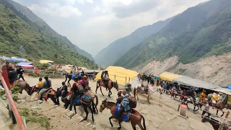
When you hear bells, mules are coming fast. Stop walking right away. Always press your body against the solid mountain wall. Do not stand near the open drop-off. Mules carry wide baskets on their sides. If one bumps into you near the cliff edge, you could easily fall off the mountain.
The trail gets super thin right before the Rambara Bridge and just after Jungle Chatti. Big crowds get stuck here all the time. Never try to squeeze past the mules in these tight spots. Just stand still and wait for them to pass.
Leave your umbrella at home. The strong mountain wind will just snap it in half. You need to pack a good, full-body rain poncho instead. If your clothes get wet up at 3,000 meters, that cold wind will freeze you very quickly.
Got sick on the trail? Stay calm and use these official numbers.
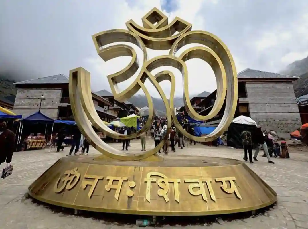
The Kedarnath trek is very hard, but a prepared beginner can absolutely do it. You just need to treat it like a real mountain climb. Accept that you have to walk the true 20km distance. Train your legs for that steep Lincholi climb, and take the low oxygen warnings seriously.
For a safe trip, wear strong boots that support your ankles. When coming back down, walk very slowly to keep your knees from hurting. Once you arrive, you will see the huge snowy mountain right behind the temple. Seeing that amazing view makes the painful walk totally worth it.
The government boards say 16 km from Gaurikund. Don’t trust that number. You are climbing a steep mountain, meaning the path zig-zags constantly to cut the incline. Because of all these extra curves, your smartwatch GPS will clock your real walk somewhere between 18 and 21 km.
Yes. Just don’t show up with zero preparation. Give yourself 4 to 6 weeks to train. Walk 5 to 10 km a day and spend serious time climbing stairs. On the actual trek? Drink tons of water and walk painfully slow. That is the only way you beat altitude sickness.
Three reasons. First, the uphill climb never stops—you gain 1,600 meters in a single day. Second, the temple sits at 3,583 meters. The air is so thin up there that your lungs have to work double just to breathe. Finally, walking back down those hard stone steps absolutely wrecks your knees.
Hit the trail early, between 4:00 AM and 5:00 AM. If you sleep in, you might not get to walk at all. The police strictly close the Gaurikund gates at 1:30 PM. Mountain weather gets nasty in the afternoon, so nobody gets past the barrier after that exact time.
About the Author: Bijoy Pal has completed the Kedarnath trek 6 times in all weather conditions. He writes his destination guides using his own smartwatch GPS data, real medical facts, and personal trail experience to help you stay safe on the mountain.