Physical Address
Bankura, West Bengal 722142
Physical Address
Bankura, West Bengal 722142

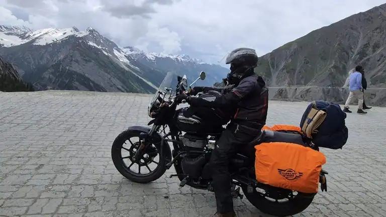
Planning a road trip from Kashmir to Ladakh? Map apps will tell you the Srinagar to Kargil distance of 202 kilometers only takes 5 hours. But if you have ever driven in the high mountains, you know that is simply not true.
On my last trip in July 2026, I made sure to leave Srinagar by 5:00 AM to cross the Sonamarg gates before 6:00 AM. This early start saved me from getting stuck behind long lines of slow army trucks. If you miss the morning police timings at Zoji La Pass or get caught in heavy traffic, your fast drive will easily take 8 long hours.
We like to keep things honest in our travel guides. Below, you will find the real taxi prices, the micro-timings for the toughest stretches, strict traffic rules, and the actual road conditions for each month. Here is everything you must know before you start driving.
In a rush? Here is what you need to know:
Here is the exact route you will take to cover the Srinagar to Kargil distance:
Srinagar → Ganderbal → Kangan → Sonamarg → Zoji La Pass → Drass → Kargil
You start low in Srinagar, climb way up into the thin mountain air, and then drop back down to reach Kargil. Because you climb so fast in just a few hours, altitude sickness is very common.
Instead of just looking at numbers, see how steep the actual climb is between Sonamarg and Zoji La:
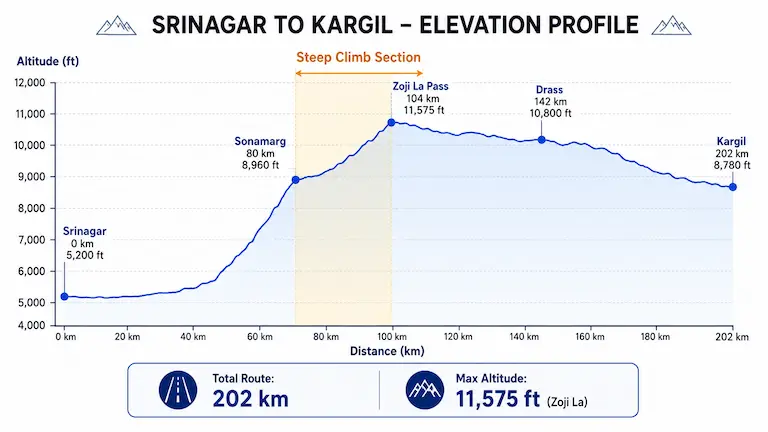
| Place | Distance | Height (Altitude) | Road Condition |
| Srinagar | 0 km | 5,200 ft | Easy, flat city roads. |
| Sonamarg | 80 km | 8,960 ft | Smooth highway. Stop here for breakfast. |
| Zoji La Pass | 104 km | 11,575 ft | The hardest part. Steep, rough dirt tracks and traffic jams. |
| Drass | 142 km | 10,800 ft | The road is good again. Wide and paved. |
| Kargil | 202 km | 8,780 ft | You made it. You are lower down now, so you can sleep well. |
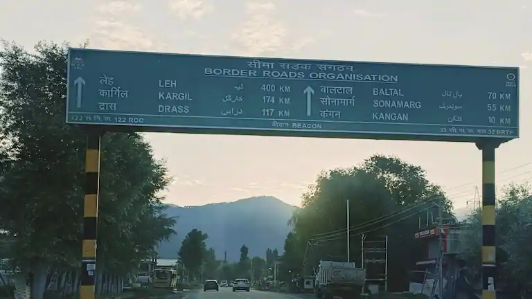
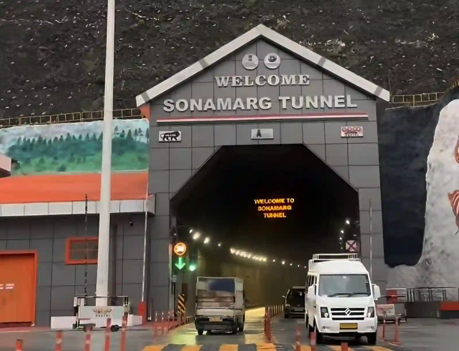
A lot of websites are sharing confusing news about the mountain tunnels. Here is the reality on the ground today:
This 6.5 km tunnel right before Sonamarg is completely open. It bypasses the old, dangerous snow zones. Because of this, your morning drive from Srinagar to Sonamarg is now super smooth and fast.
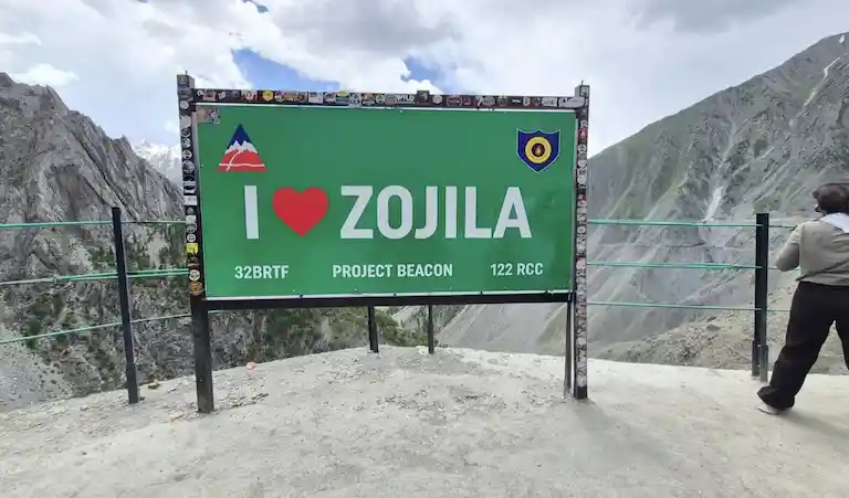
You might see news claiming the massive Zoji La Tunnel is complete. Don’t fall for it. The mountain digging is done, but the inside of the tunnel is not ready for cars yet. It will not open for tourists until February 2028.
What this means for your trip: You cannot use the new tunnel as a shortcut yet. You still have to drive your car all the way up and over the actual mountain pass. Be ready for massive drops, crawling convoys, and zero safety barriers at 11,000 feet.
You know the total drive takes 6 to 7 hours, but the pacing is completely uneven:
Altitude sickness (AMS) hits hard at Zoji La (11,575 ft). If anyone in your vehicle experiences severe dizziness or shortness of breath, the nearest reliable emergency oxygen is located at the Army and civil medical camps in Sonamarg (before the pass) and Drass (after the pass). There are no medical facilities at the top of Zoji La itself.
Zoji La Pass is very narrow. Two big trucks cannot fit next to each other. To stop traffic jams, the police look at the calendar date:
(Note: Later in the summer, the police often open the road for both sides during different times of the day. But don’t risk it. Just plan your trip around the one-way rule).
Even if you pick the right day, you can’t just cross the mountain whenever you feel like it. The police close the gates at fixed times.
Never guess if the road is open. Before you walk out of your hotel, quickly check these official sources:
The vehicle you choose completely changes how fast you can cover the Srinagar to Kargil distance. Here is how long it actually takes based on our own rides:
| Vehicle | Time | Why it takes this long |
| Big SUV (Innova) | 6 Hours | Big tires and high ground clearance make bad roads easy. |
| Small Car (Dzire) | 6.5 Hours | You have to drive very slowly over the rocks at Zoji La. |
| Bike (Enfield) | 6 to 7 Hours | You can cut through traffic, but you will need stops because of the freezing wind. |
| Shared Taxi (Sumo) | 7 Hours | The cars are fast, but waiting for all passengers to get in wastes time. |
| Government Bus | 8+ Hours | It is a big, heavy vehicle that moves very slowly on steep mountains. |
The highway changes its personality every month. Here is what to expect depending on when you travel:
Since covering the Srinagar to Kargil distance takes up to 7 hours, you need to break it up. Treat this as a road trip, not a race.
This is your last major town in Kashmir before the dry mountains take over. Stop here for a heavy breakfast (hot Aloo Parathas and Chai). This is also where you show your IDs at the police check-post.
Right as you clear the worst, most terrifying part of the pass, you will see a massive open valley. Local vendors set up small tents here selling hot Maggi noodles and coffee. The freezing mountain wind combined with a hot bowl of noodles is one of the best feelings on the drive.
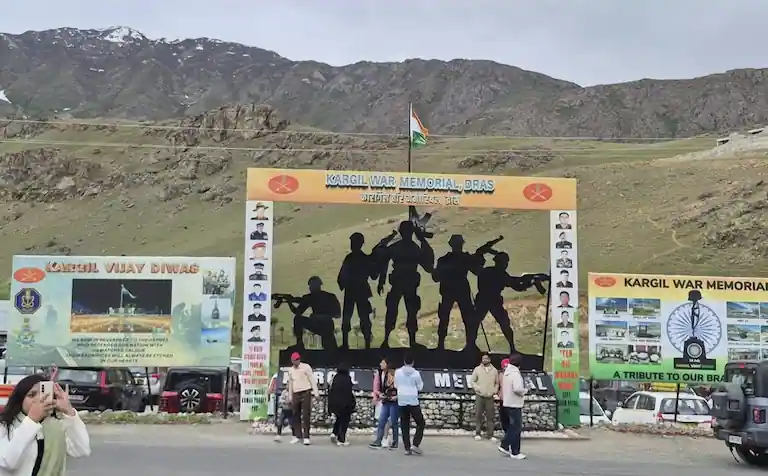
Located right on the main NH1 highway, the Drass War Memorial was built by the Indian Army to honor the brave soldiers who died in the 1999 Kargil War. It is a deeply moving experience. If you look up, you can see the actual Tololing and Tiger Hill mountain peaks behind the memorial.
Once you arrive in Kargil, you need a place to rest. If you are on a budget or planning to take public transport the next morning, find a hotel near the New Bus Stand or the main market. Basic guesthouses and budget hotels cost around ₹1,000 to ₹1,500 per night and put you in the perfect starting position for the next leg of your journey to Leh.
On a map, the Srinagar to Kargil distance of 202 kilometers looks like a quick trip. But this drive changes everything. You leave the green forests of Kashmir and enter the dry, rocky mountains of Ladakh.
Do yourself a favor: check the road rules the night before, get a strong vehicle, and start driving while it is still dark outside. Get to Kargil, grab a hot meal, and get some proper sleep before you head deeper into the Himalayas. When you wake up, you can use our complete guide on the Leh to Kargil distance and route to safely plan the second half of your road trip. Driving the Zanskar loop back to Himachal? Read our guide on crossing Shinkula Pass first.
It is pretty sorted for the most part. Srinagar to Sonamarg is a breeze, and the stretch from Drass to Kargil is a proper, wide highway. The only headache is Zoji La Pass. Those 25 kilometers are completely raw—expect deep mud, loose rocks, and a very bumpy ride.
Completely. The Army and BRO (Border Roads Organisation) practically live on this highway, so the route is heavily guarded and well-maintained. Just respect the mountain curves, don’t rush the blind turns, and you won’t have any problems.
Possible, but it’s a terrible idea. Covering 420 km in the mountains means 14 to 16 hours of straight driving. It is completely exhausting and ruins the fun of the trip. Stop at Kargil for the night. Your body needs it to handle the altitude shift, and your driver needs the sleep.
Author Bio: Bijoy Pal is a traveler, rider, and the creator of Brief Voy. He rides across the Himalayas himself to share real travel times, bus schedules, and simple, honest destination guides for people visiting Ladakh on a budget.