Physical Address
Bankura, West Bengal 722142
Physical Address
Bankura, West Bengal 722142

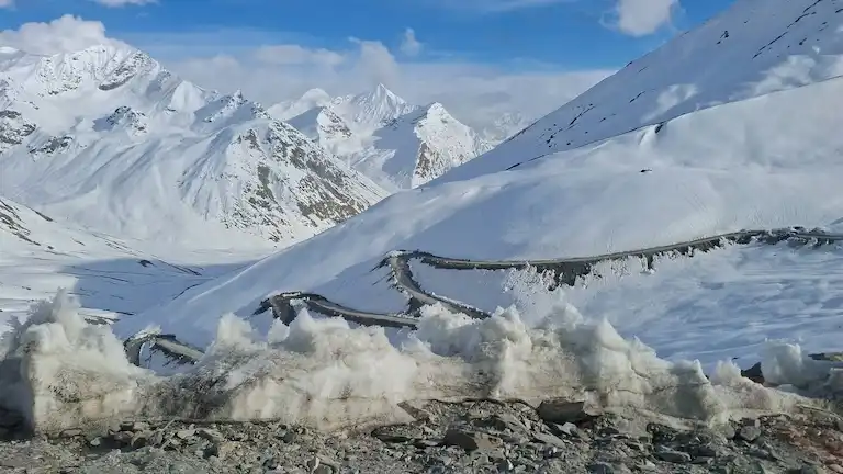
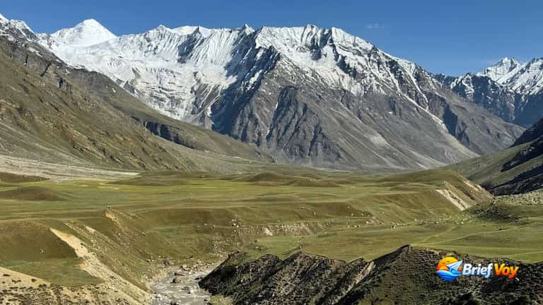
Driving from Himachal Pradesh to Zanskar is a tough mountain trip. Before Shinkula Pass opened, you had to take a long detour through Kargil. Now, this pass (also called Shinku La, Shingo La, or Shinkun La) gives you a direct shortcut. As of September 2026, Shinkula Pass is fully open to all 4×4 and high-clearance vehicles.
The pass sits at 16,703 feet (5,091 meters). Driving at this height is hard work. You have to handle thin air, freezing river crossings, and strict local taxi union rules.
This guide cuts out the fluff. You will find exact distances, daily plans, trip costs, fuel advice, hospital locations, and clear permit rules.
To give you the most accurate details, I tracked this route using GPS on the ground.
The Shinkula Pass road is part of a big government project called the Nimmu-Padum-Darcha (NPD) Highway. Before this road, drivers had to cross five high and dangerous mountain passes on the Manali-Leh highway to get to Ladakh. The new Shinkula route goes straight through the mountains. By taking this road, you skip four tough passes and only cross one. This saves a lot of time and helps you avoid heavy snow. Many road-trippers use this route to enter Zanskar and complete the loop by driving the Srinagar to Kargil highway on the way back
Before the government built this route, a local man named Tsultrim Chonjor (Meme Chonjor) made the first 38 kilometers himself. Between 2014 and 2017, he used his own life savings of ₹57 lakh to hire earthmovers. He wanted a road from Ramjak to Kargyak so his village would stay connected. In 2021, India honored him with the Padma Shri for his effort.
You cannot fly or take a train directly to Shinkula Pass. Your trip has to start from Manali.
The closest airport is Bhuntar in Kullu, about 50 kilometers from Manali. But flights there are few and often get canceled due to bad weather. A better choice is flying into Chandigarh and taking a taxi to Manali, which takes about 8 hours.
Chandigarh is the nearest major railway station. From Chandigarh, you can just book a Volvo bus or a taxi to Manali.
First, you need to reach Manali. From there, drive on the Manali-Leh Highway (NH-3) through the Atal Tunnel until you get to Darcha. At Darcha, leave the main highway, take a left, and drive up to the pass.
If you are not bringing your own car, you must know these local union rules:
The army (BRO) decides when this road opens. It usually stays open from late May to mid-October, but the driving conditions change every month.
Temperature: Daytime 5°C to 12°C | Nighttime -5°C to 0°C
The road opens in late May. You will see huge snow walls at the top, but melting ice makes the road very muddy and slippery. Only bring a 4×4 vehicle during these early weeks.
Temperature: Daytime 15°C to 20°C | Nighttime 5°C to 10°C
Zanskar itself is dry, but the route from Manali gets heavy monsoon rain. Watch out for landslides. Also, the mountain rivers are at their deepest and most dangerous right now.
Temperature: Daytime 10°C to 15°C | Nighttime 0°C to -8°C
This is the best and safest time to drive. The rain stops, the sky is clear, and the river water levels drop. The valley turns a beautiful orange color. By late October, fresh snow closes the road completely for winter.
Make sure you know the facts before you reach the police checkpost.
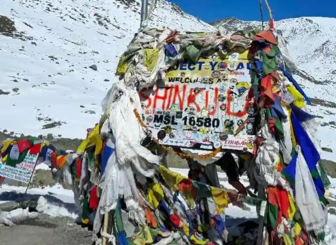
Altitude Note: Old road signs and blogs say 16,580 feet (5,050 meters). However, new GPS readings and BRO records confirm the real top is 16,703 feet (5,091 meters).
Most blogs say you lose all network after Darcha. They miss a huge detail: prepaid SIM cards from outside J&K and Ladakh go completely dead here because of government security rules.
Many websites give wrong permit advice for this route. Here are the actual rules:
Everyone must stop at Darcha. The police will note down your car number, driving license, and ID cards. This is just a free security check, not a paid permit.
Indians do not need a permit for Shinkula Pass. Because Zanskar is in the Kargil district (not Leh), you also do not have to pay any Ladakh Environment Fees. You can just drive straight through.
Foreigners do not need a Protected Area Permit (PAP) for the main Zanskar route. A standard passport and a valid Indian visa are enough. (PAPs are only needed if you go to border zones like Nubra later).
For offline navigation, you can download our tracked route data directly to your device or view the live map below.
Download Route Data: Download Manali to Padum GPX File
Here is a simple look at the path you will take and the main stops.
Driving from Manali to Padum in one day is dangerous. You climb too high, too fast, and driving on cliff edges in the dark is risky. Use one of these two plans instead.
Best if you are short on time.
Best if you want to enjoy the views and visit the famous cliffside monastery.
Start in Manali and cross the 9 km Atal Tunnel into Lahaul Valley. Drive past Sissu and Tandi. Old blogs say Tandi is the last petrol pump, but Keylong now has a working IOCL pump (Upasak Filling Station). Fill your tank completely here. Continue past Jispa to reach Darcha.
Right after the Darcha police post, turn left and cross the metal bridge. The smooth tarmac ends here. The route becomes a single dirt track passing Rarig and Chikka. The climb gets very steep with loose stones, so stick to a low gear. At the top (5,091 meters), you will see prayer flags. Leave within 15 minutes to avoid a severe altitude headache.
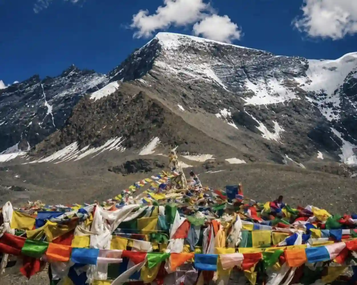
The drive down into Ladakh is very steep. Watch for falling rocks. When you reach the flat Lakhang Sumdo valley, stay exactly on the old tyre tracks so you don’t sink into the soft dust. Soon, you will see Gonbo Rangjon, a massive, holy rock mountain standing alone in the valley.
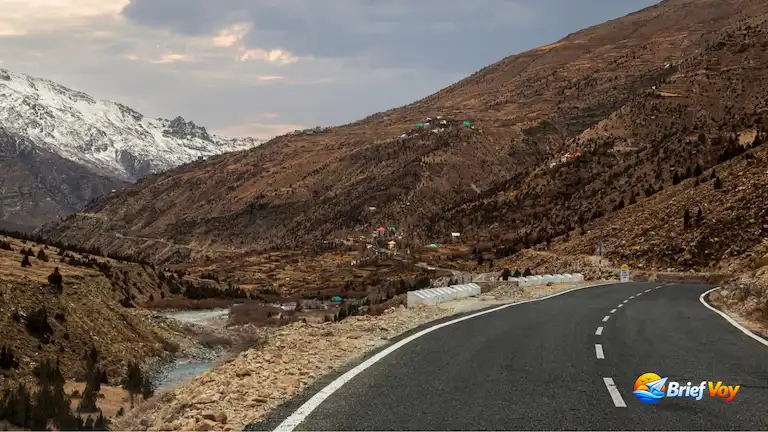
Follow the river past the old stone villages of Kargyak and Purne. The road is cut right into the cliff and gets extremely narrow here. Finally, the valley widens out, and you drive straight into Padum town.
| Place | Height | Distance | Safe Speed | Road Notes |
| Manali Town | 2,050 meters | 0 km | 40 km/h | Busy city traffic |
| Atal Tunnel | 3,060 meters | 34 km | 60 km/h | Strict speed limits |
| Keylong Pump | 3,080 meters | 71 km | 45 km/h | Last petrol pump |
| Darcha Post | 3,360 meters | 100 km | 35 km/h | Police ID check |
| Chikka Stream | 3,820 meters | 112 km | 15 km/h | Slippery wet rocks |
| Shinkula Summit | 5,091 meters | 140 km | 10 km/h | Very steep turns |
| Gonbo Rangjon | 4,420 meters | 170 km | 25 km/h | Deep, soft dust |
| Purne Village | 3,700 meters | 204 km | 20 km/h | Blind cliff corners |
| Padum Market | 3,565 meters | 245 km | 45 km/h | Smooth road again |
If you take your own car from Manali to Padum, here are the rough costs:
At 16,000 feet, thin air makes your engine work much harder. If you normally get 13 km per liter on the highway, expect only 5 or 6 km per liter on this dirt road.
Always use metal jerry cans. Plastic cans will expand and burst at high altitudes, leaking fuel all over your car.
Doing this on a bike is tough. Your machine needs to be ready.
There are no bridges near Chikka and Lakhang. You must drive straight through the streams. Always cross in the morning (6 AM to 10 AM) when the water is lowest. By afternoon, melting ice makes the water dangerously deep.
Altitude sickness hits hard up here. Watch out for bad headaches, throwing up, and heavy fatigue.
| Place | Type of Hospital | What They Can Do |
| Darcha Base | Army Medical Post | Basic first aid and oxygen. |
| Keylong | District Hospital | Doctors, X-rays, and oxygen rooms. |
| Top of the Pass | None | You are completely on your own. |
| Padum Town | Government Hospital | Doctors and basic ambulances. |
Buy a cheap finger pulse oximeter. If your oxygen reading drops under 70, turn the car around and drive down immediately.
Right now, surface travel over the 16,703 ft summit remains mandatory for all tourists. However, the government is building a tunnel straight through the rock under the pass.
This is called Project Yojak. The tunnel will be exactly 4.1 kilometers long. Portal excavation and foundation blasting officially began in mid-2024. The tunnel is an active Border Roads Organisation construction zone targeted for completion around 2028. It will bypass the highest part of the mountain completely, sitting at an altitude of 15,800 feet. When finished, it will be the highest road tunnel in the world.
Jispa has nice hotels with warm beds and hot running water. Darcha only has small roadside food stalls for a quick hot meal.
During the summer, local people set up thick tents near the holy mountain. A tent stay here usually costs between ₹1,000 and ₹1,500 per night, which includes a sleeping bag and hot food. It gets freezing cold at night, but the stargazing is incredible.
Purne has basic village guesthouses. The Dolma Guesthouse is a reliable option here. The bathrooms are outside, but it is the best place to sleep if you want to hike up to the famous Phugtal Monastery the next morning.
Padum has normal hotels with nice beds, attached bathrooms, hot water, and restaurants.
You will not find any mechanics on this road. You have to fix your own flat tyres. Fill up your spare tyre in Manali. Pack an electric air pump and a puncture kit so you can plug holes yourself.
If your car gets stuck in the deep mud, a heavy tow rope is the only way to get pulled out. You should also keep warm sleeping bags right next to you inside the car cabin, just in case you get stranded in the freezing cold.
Bring plenty of cash because UPI payments will not work and village ATMs are usually empty. Finally, make sure to download offline maps on your phone before you leave town and lose the internet connection.
Yes, it can be. At 16,703 feet, many people get sick from the thin air. The roads are just dirt and have no safety walls. Because of falling rocks and deep river crossings, you definitely need a tough vehicle and solid driving skills.
Do not take a 2-Wheel Drive (2WD) car in May or June. The mud and ice are too deep. In late August and September, the road is drier. A high-clearance 2WD can make it, but only if you are an expert mountain driver. Regular small cars and hatchbacks will get stuck.
No, you do not need an inner line permit. Indian citizens just need to show an ID card and register their vehicle at the Darcha police checkpost.
They are very different. Rohtang Pass is a paved road, much lower (13,058 ft), and crowded with tourists looking for snow. Shinkula Pass is much higher (16,703 ft), unpaved, empty, and meant for serious road trip adventures into the Zanskar Valley.
About the Author: Bijoy Pal is the lead travel writer for Brief Voy. He explores remote, offbeat corners of South Asia in his 4×4, personally testing rough mountain roads and checking trip costs to share real, field-tested destination guides.