Physical Address
Bankura, West Bengal 722142
Physical Address
Bankura, West Bengal 722142

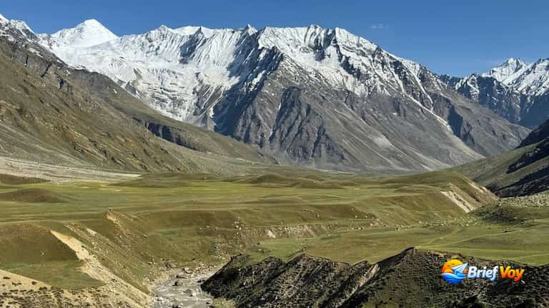
Most hikers completely miss the Miyar Valley trek in Lahaul, Himachal Pradesh. You drop entirely off the grid out here, because phone signals just do not exist. Climbers call this place the “Yosemite of the Himalayas.” Once you see the giant rock walls shooting up from the flat green fields, you will understand why.
Hundreds of people crowd into famous routes like Hampta Pass every single morning. Miyar gives you the exact opposite experience. You can spend hours walking next to freezing rivers and across massive valleys, and you probably will not see another person all day.
When you look for guides online, you mostly find travel agencies trying to sell a ₹15,000 tour package. They hide the practical stuff you need to travel solo. I hiked this trail myself, so I built this guide for independent backpackers. Down below, I share the exact route, the true DIY costs, HRTC bus timings, and the hidden trail dangers that agencies never mention.
Miyar Valley is a massive, high-altitude basin stretching over 100 kilometers between the Pir Panjal and Zanskar mountain ranges. While the lower parts of the valley are filled with small farming villages and Buddhist shrines, the upper valley turns into a wild landscape of long glaciers and heavy boulders.
It acts as a natural mountain bridge connecting Himachal Pradesh to the remote Zanskar region. During the summer months, nomadic Gaddi shepherds bring their flocks of sheep here from the lower plains to feed on the rich, untouched grass.
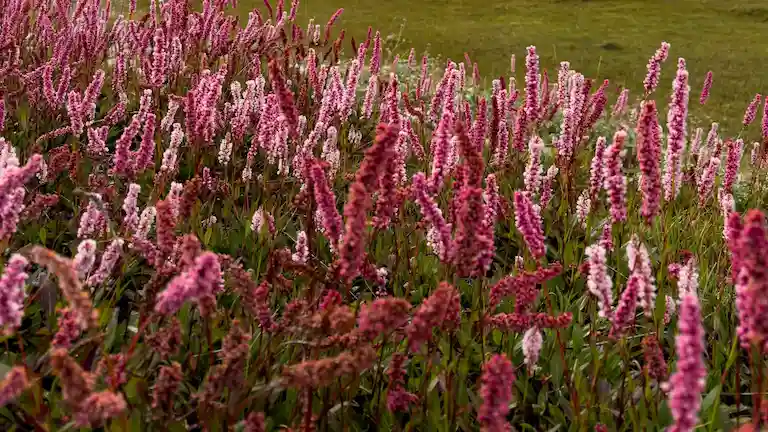
Miyar Valley is a thriving alpine ecosystem. Trekkers with a sharp eye might spot Himalayan brown bears, elusive snow leopards, or Himalayan marmots darting through the higher rocky outcrops. If you time your trek for July or August, the valley floor bursts into a carpet of color, featuring the famous and incredibly rare Himalayan Blue Poppy (Meconopsis baileyi) blooming across the meadows.
Beyond just a valley trek, Miyar is the famous gateway to the Kang La Pass (17,250 ft / 5,468 m). While motorists enter Zanskar via the drivable Shinku La Pass, extreme mountaineers use this exact route to cross the massive 24-kilometer Miyar Glacier over the Kang La Pass directly into the remote Zanskar region of Ladakh.
Many blogs say this trek is “Easy to Moderate” because the climb is slow and flat. While you do not have to climb steep hills, the ground has its own unique dangers that independent trekkers must know before they go:
Miyar Valley is famous for its wide, flat meadows. But to walk through them, you have to cross many small, ice-cold streams that flow into the main river.
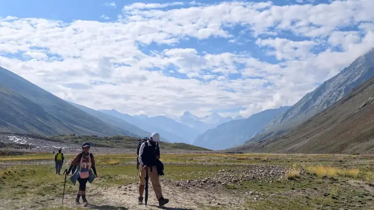
Because Lahaul is a high-altitude cold desert, the air is very thin and dry.
Because of the new roads, reaching the basecamp is faster than ever.
In the past, trekkers started walking from Urgos. Today, the dirt road goes past Urgos and ends at Shukto (84 km from Keylong). From Shukto, you walk across a wooden bridge over the Miyar River to reach Khanjer. Khanjer is the last village where people live.
Most online itineraries hide the daily climbing numbers. Here is exactly how far you will walk and climb every single day.
| Metric | Details |
| Drive Distance | 140 km (5 to 6 hours) |
| Trek Distance | 1 km (Short village walk) |
| Starting Altitude | 6,700 ft (Manali) |
| Ending Altitude | 11,564 ft (Khanjer) |
| Altitude Gain | 4,864 ft |
| Altitude Loss | 0 ft |
Arrive at Shukto by bus or taxi. Cross the bridge with your bags to reach Khanjer. Drop your bags at your homestay and spend your evening walking around the village farms to let your body adjust to the sudden jump in altitude.
| Metric | Details |
| Trek Distance | 9 km |
| Starting Altitude | 11,564 ft |
| Ending Altitude | 12,345 ft |
| Altitude Gain | 781 ft |
| Altitude Loss | 0 ft |
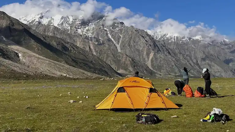
After breakfast, you walk past the local village farms and leave Khanjer behind. The trail goes up very slowly through beautiful green fields. You will cross your first few small water streams today. Yolling is a very quiet, peaceful place to camp, surrounded by tall mountain peaks.
| Metric | Details |
| Trek Distance | 12 km |
| Starting Altitude | 12,345 ft |
| Ending Altitude | 12,667 ft |
| Altitude Gain | 322 ft |
| Altitude Loss | 0 ft |
This is a long day of walking. The valley opens up wide today, showing off the massive, flat rock faces that give Miyar its “Yosemite” nickname. The walking path stays mostly flat but gets a lot more rocky under your boots. Zardong is a huge, open camping ground with plenty of fresh drinking water nearby.
| Metric | Details |
| Trek Distance | 13 km |
| Starting Altitude | 12,667 ft |
| Ending Altitude | 13,200 ft |
| Altitude Gain | 533 ft |
| Altitude Loss | 0 ft |
Today you walk deeper toward the main Miyar Glacier. The soft green grass slowly turns into loose rocks and hard ice. Kesar Yon Choo has beautiful, clear glacial lakes and seven small icy ponds. This is the final stop for most trekkers before they turn around to go home.
| Metric | Details |
| Trek Distance | 10.5 km |
| Starting Altitude | 13,200 ft |
| Ending Altitude | 12,800 ft |
| Altitude Gain | 0 ft |
| Altitude Loss | 400 ft |
Start your walk back down the valley. Instead of stopping at Zardong, you will camp at the beautiful Gompa campsite. Walking back feels much faster and easier on your lungs because you are finally going downhill.
| Metric | Details |
| Trek Distance | 14 km |
| Starting Altitude | 12,800 ft |
| Ending Altitude | 11,564 ft |
| Altitude Gain | 0 ft |
| Altitude Loss | 1,236 ft |
Your final long day of walking takes you through the gorgeous Tharang meadows. You will reach Khanjer village by late afternoon. Take off your heavy boots, rest your tired legs, and enjoy a hot home-cooked meal at your homestay.
| Metric | Details |
| Drive Distance | 140 km (6 hours) |
| Trek Distance | 0 km |
| Starting Altitude | 11,564 ft |
| Ending Altitude | 6,700 ft |
| Altitude Gain | 0 ft |
| Altitude Loss | 4,864 ft |
Wake up early, walk back across the bridge to Shukto, and catch your pre-arranged taxi or the morning HRTC bus. This will take you back to Keylong, and then finally back to Manali.
If you already own your camping gear (a tent, a sleeping bag made for -10°C, and a cooking stove) and have hiked in the Himalayas before, doing this trek on your own is very cheap.
If you do not want the stress of carrying a tent or cooking your own food, you can pay a company to do it for you. Standard agency costs range from ₹15,000 to ₹19,000 (starting and ending in Manali).
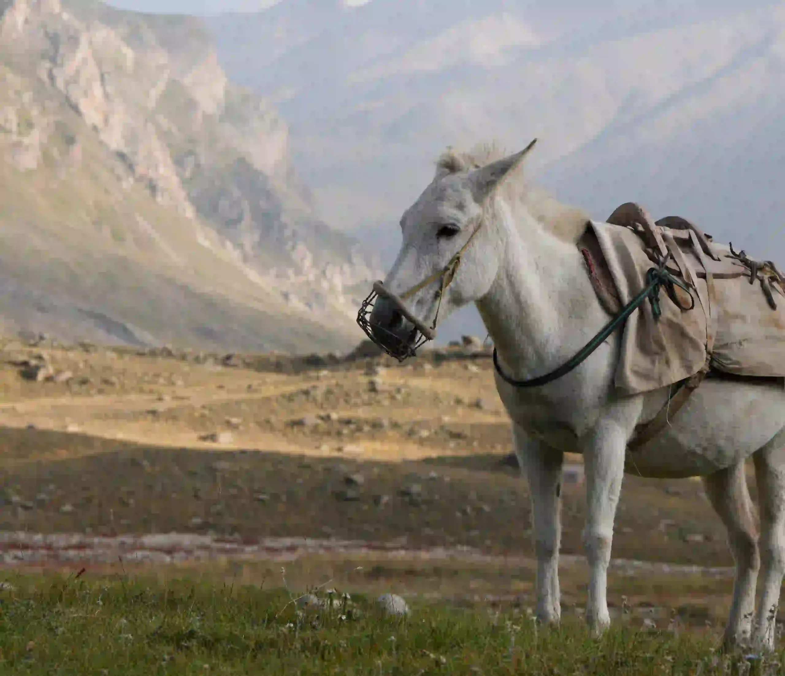
There are no shops, no phone network, and no porters out here. Bring a 50-60L backpack with a rain cover. You also need a big poncho that fits right over you and your bag. Wear high-ankle waterproof boots. Vibram soles are the best. Pack gaiters for the mud and cheap sports sandals to walk through rivers. If you camp by yourself, a 3-season tent and a -10°C sleeping bag are a must.
Keep your clothes simple. Pack 3 quick-dry shirts, 2 hiking pants, 1 fleece, and a thick down jacket for the freezing nights. The cold mountain air kills batteries super fast. Do not use your phone as a flashlight. Bring a good headlamp with spare batteries and a 10,000mAh power bank.
The sun is very strong up high. You need dark Category 3 or 4 sunglasses. The river water looks clean, but local cows leave waste nearby. Always treat your water with a squeeze filter or drops before drinking. Finally, carry a basic first-aid kit. Be sure to pack blister tape for your feet and Diamox for altitude sickness (check with your doctor first).
Look at the mountain forecast while you still have network in Manali. You cannot check a weather app once you hike past Udaipur, and the cold hits fast as soon as the sun goes down.
| Trekking Month | Daytime Temp | Nighttime Temp | Weather Conditions |
| Late May to June | 12°C to 18°C | 0°C to -3°C | Warm sun, green grass, and blooming flowers. |
| September to Mid-Oct | 10°C to 15°C | -3°C to -10°C | Clear blue skies, great mountain views, freezing nights. |
The trail is mostly flat, so you won’t climb many steep hills. The hard part is the rough ground. You will walk on loose river rocks and cross freezing ice water for hours. You really need strong legs and boots with good ankle support.
Going DIY with local buses and your own tent keeps costs under ₹9,000 from Manali. Fixed tour agencies charge up to ₹19,000 for a package. Remember that Keylong has the last working ATMs on the route, so pull out all the cash you need there for food and homestays.
Indians do not need an Inner Line Permit. You may just have to pay a small forest camping fee on the trail. Foreigners must carry passport copies and check the latest Lahaul border permit rules.
The trail is easy to follow, but you are totally alone with zero phone signal. If you get sick or hurt an ankle, no one is there to help. If you travel solo, hire a local guide from Khanjer village to stay safe.
About the Author: Bijoy Pal is a digital publisher and Himalayan traveler who spends his time exploring Spiti, Lahaul, and hidden mountain trails. As the founder of BriefVoy, he writes honest destination guides to share exact road routes and real costs with independent travelers. Bijoy took all the photos in this guide himself to show you exactly what the trail looks like.