
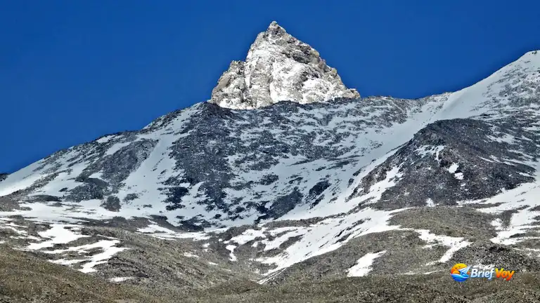
The windy Kinnaur district sits right on the Indo-Tibetan border. Trekkers usually ignore the peaks out here. But this is exactly where Reo Purgyil stands. It reaches 6,816 meters (22,362 feet) high. That makes it the tallest peak in all of Himachal Pradesh. Oddly, even expert climbers get confused by this mountain. They mix it up with Leo Pargial. That is actually just a shorter twin peak sitting right next to it.
Famous trails in Garhwal and Nepal get too crowded today. This mountain is completely different. It stays very quiet and wild. You come here for a hard 6,000-meter climb with no traffic jams around. This guide gives you the real history of the peak. It also covers the exact trekking path from Nako village, the strict border permits, and the actual ground conditions you will face on the climb.
The Great Identity Theft: Reo Purgyil vs. Leo Pargial
To understand this mountain, you must know about an old map mistake. This is an important fact missing from most online guides.
There are two main peaks here:
- Peak 6,816m (Reo Purgyil): The real highest peak, located about 2 kilometers south.
- Peak 6,791m (Leo Pargial): The slightly shorter twin mountain.
According to historical records from the Himalayan Club, early British mapmakers went up the Spiti river past Leo village. A mix-up with the local names caused them to label the summit “Leo” instead of “Reo.” Because of this mistake, Leo Pargial (6,791m) made it onto official maps while the taller peak was left as just an unnamed number.
Local Kinnauri and Spitian people call the taller mountain Reo Purgyil. To avoid any mix-ups, specifically ask your agency and the Indian Mountaineering Foundation (IMF) to book Peak 6,816m so you don’t end up on the shorter mountain.
A Timeline of Historical Ascents
Because it is far away and hard to climb, Reo Purgyil only has a few successful summits.
- 1971: The first official climb was completed by a team from the Indo-Tibetan Border Police (ITBP).
- 1991 (July 26): The second climb by an Indian team, led by climber E. Theophilus (documented in The Himalayan Journal).
- 2018 (August 11): A successful civilian expedition led by Rajsekhar Maity and a team from West Bengal.
- 2020: A 12-member ITBP team reached the top during the COVID-19 pandemic, fighting heavy snow and high winds.
Why Climb Reo Purgyil? The Alpinist’s Appeal
Forget about a normal trekking trip. This is a tough, remote expedition.
- The Highest Peak: At 6,816 meters, it is the absolute tallest mountain in Himachal Pradesh, standing just above Mount Gya (6,794m).
- Cold Desert Terrain: The route cuts through the freezing high-altitude deserts of Kinnaur and Spiti. It looks exactly like Tibet, offering nothing but endless dry rocks instead of green valleys.
- True Isolation: Your group will likely have the mountain completely to yourselves. There are no fixed safety ropes, busy base camps, or warm tea houses waiting for you here.
Quick Facts: Expedition At A Glance
| Metric | Details |
| Peak Name | Reo Purgyil (Often mislabeled as Leo Pargial) |
| Elevation | 6,816 meters (22,362 feet) |
| Location | Southern Zanskar Range, Kinnaur District, Himachal Pradesh |
| Duration | 20 to 24 Days (Delhi to Delhi) |
| Difficulty | Strenuous / Highly Technical (Alpine Grade: AD+/D) |
| Best Season | Late July to early September |
| Starting Point | Nako Village (3,662m) |
| Permits Required | IMF Peak Royalty, Inner Line Permit (ILP), Mandatory Liaison Officer |
Ground-Level Transit, Logistics & Costs
The Highway Route and Transit Costs
Take the NH-5 highway to Reckong Peo, and then turn onto NH-505 toward Nako. An HRTC bus from Delhi to Reckong Peo costs about ₹1,140 and takes roughly 16 hours. From there, just hop in a shared cab or a local bus to finish the trip to Nako.
Inner Line Permits & Checkposts
The Indo-Tibetan Border Police (ITBP) keeps a close watch on this highway. They will definitely stop you to check your paperwork at the Khab and Chango checkposts, so keep your permits handy.
Itemized Expedition Cost Estimator
| Expense Item | Estimated Cost |
| IMF Peak Royalty | ₹20,000 – ₹50,000 (Indians) / $500 – $1,000 (Foreigners) |
| Liaison Officer (LO) Gear | ~$500 USD (Mandatory fee paid to the IMF) |
| Nako Mule Hire | ₹800 – ₹1,200 per mule, per day |
| Inner Line Permit (ILP) | ₹120 – ₹500 at the Reckong Peo DC office |
The Ultimate Route Breakdown (The Nako Approach)
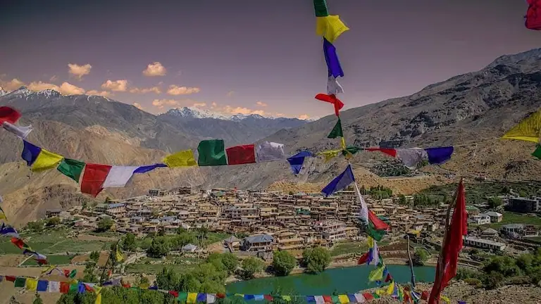
The main trek starts in Nako (3,662m), a village famous for its sacred lake and an ancient 1025 AD monastery. Follow this exact schedule so your body gets used to the altitude safely.
The Approach and Acclimatization
Day 1 to 4: Delhi to Nako via Shimla
Drive the NH-5 from Delhi through Shimla and Reckong Peo. This slow drive helps you acclimatize. You can also drive from Manali via Kaza, but only if Kunzum Pass is clear of snow.
Day 5 and 6: Active Acclimatization in Nako
Don’t rush this. Nako is high up at 3,662 meters. Take short walks, pack the mules, and double-check your gear.
The Trek to Base Camp
Day 7: Nako to Transit Camp 1
It is a steep 4 to 5 kilometer walk from Nako (GPS: 31°52′53″N, 78°37′38″E) up to Transit Camp 1 at 4,200 meters (GPS: 31°52′57″N, 78°39′12″E). Mules take the heavy bags. There is no water on this dusty trail, so carry plenty to drink.
Day 8: Transit Camp 1 to Transit Camp 2
The climb continues to Transit Camp 2 at 4,800 meters (GPS: 31°53′00″N, 78°40′35″E). Dirt paths vanish here, forcing you to walk over loose, sharp rocks instead.
Day 9: Transit Camp 2 to Base Camp
Freezing winds hit you constantly on this tough 6-kilometer stretch to Base Camp at 5,300 meters (GPS: 31°53′01″N, 78°42′10″E).
The Alpine Ascent (Load Ferrying & High Camps)
Life above Base Camp revolves around carrying supplies high and sleeping low.
Day 10 to 13: Establishing Camp 1
Reaching Camp 1 at 5,800 meters means crossing massive boulders. Once on the glacier, deep ice cracks force the whole team to rope together. It takes a few days just to haul food and tents higher, followed by your first night sleeping there on Day 13.
Day 14: Camp 1 to Summit Camp
The mountain suddenly gets steep and icy in extremely thin air. Summit Camp sits on flat ice at 6,300 meters (GPS: 31°53′02″N, 78°43′15″E). Nights up here are brutal, bringing -20°C temperatures and howling 40 km/h winds.
The Summit Push
Day 15: Summit Camp to Summit and Return
Start climbing around midnight while the snow is frozen solid. Hit the 6,816-meter peak (GPS: 31°53′02″N, 78°44′06″E) for stunning views of Tibet and Spiti. Hurry back down before the afternoon sun melts the snow and makes it dangerous.
Day 16 and 17: Reserve Summit Days
Weather up here changes instantly. Keep these extra days in your schedule in case bad storms trap you inside.
Day 18 to 24: The Descent
Hike back down to Base Camp, walk out to Nako, and drive home.
Technical Difficulty, Terrain Analysis & Climbing Profile
Reo Purgyil is a very tough mountain with an Alpine Grade of AD+/D. You need real climbing skills for this trip. The lower section is just endless loose rocks and dirt. You slide backward with almost every step you take. This completely drains your energy before your boots even touch the snow.
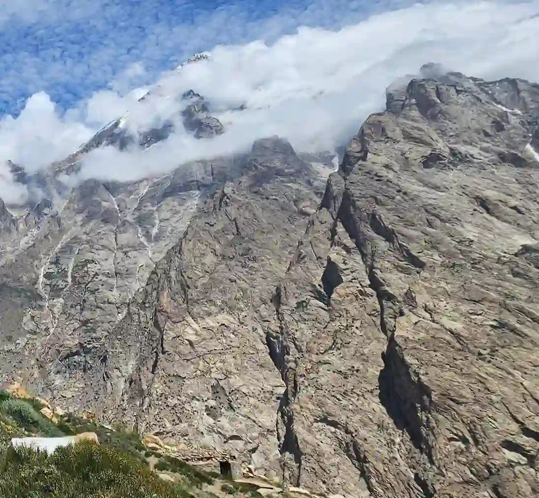
Higher up on the glacier, you will run into deep cracks in the ice. Everyone has to walk tied to a rope and know how to pull someone out if they fall in. The last 500 meters to the top are brutal. You have to climb steep rock and solid blue ice slopes that tilt up to 55 or 60 degrees. You will use front-pointing crampon techniques just to hang on and keep moving up.
Finally, you have to fight the weather. Because this peak sits right against the Tibet border, the winds are unbelievably strong. The freezing air constantly blasts the mountain. You have to keep all your skin covered the entire time so you do not end up with frostbite.
Permits, Bureaucracy, and Safety Protocols
You cannot just show up and climb. You have to book the peak online with the Indian Mountaineering Foundation (IMF) in New Delhi. Your team leader must be at least 25 years old with advanced climbing training. Plus, a government Liaison Officer (LO) has to travel with your group.
Because this mountain borders Tibet, the ITBP police check permits very strictly. Indian climbers need an Inner Line Permit (ILP), while foreigners need a Protected Area Permit (PAP). The rules continue even after your trip. You must send the IMF a final report and photos to prove you packed out all your trash.
Communications are tightly controlled here. The Indian Wireless Telegraphy Act bans satellite devices like Thuraya, Iridium, and Garmin InReach. You can only carry them if the MHA and ITBP give you special clearance first. You even need permission to use standard walkie-talkies. BSNL cell phones work in Nako, but you lose all signal after Transit Camp 1.
High-Altitude Medical & Emergency Protocols
Treating Altitude Sickness
Regular first aid kits are useless against dangerous altitude sickness like HAPE or HACE. You really need to bring a Gamow bag. This is a small pressure tent that helps sick climbers recover fast. Also, bring Diamox pills (Acetazolamide). Just check with a doctor first about how much to take.
Supplemental Oxygen Rules
Going up to Summit Camp without medical oxygen is a bad idea. Make sure to pack at least one extra oxygen cylinder for every three people in your group. If the high altitude hits someone and they stop breathing normally, you have to use this right away.
Helicopter Rescue & Evacuation
The nearest army helipads are located down in Pooh and Reckong Peo. Calling in a rescue chopper requires contacting the Kinnaur District Magistrate and the ITBP Battalion HQ in Khab. Your medical insurance must cover helicopter rescues up to 7,000 meters.
High-Altitude Gear and Logistics
| Gear Item | What to Bring | Why You Need It |
| Boots | Double or triple insulated (La Sportiva G2 SM or Spantik) | Prevents frostbite above 5,800m in -20°C temps. |
| Ropes | Two 50m semi-static ropes (8.5mm to 9mm) | For crevasse rescues and climbing steep ice. |
| Hardware | Snow stakes, 17-21cm ice screws, and crampons | Required for the steep 500m summit push. |
| Tents | 4-season geodesic expedition tents | Blocks 50 km/h winds high up on the ridges. |
High-Altitude Fuel & Water Mechanics
Past Transit Camp 2, there is no running water at all. You just have to melt ice to get your drinking water. Regular Isobutane-Propane gas cans will freeze up and quit working up here. Bring liquid fuel instead, like MSR White Gas. It burns fine even when the temperature drops to -20°C. It takes a ton of heat to melt that ice. Plan to carry 0.25 to 0.3 liters of fuel per person, per day, just for making water.
Conclusion
You should not try Reo Purgyil if you are a beginner. The climb will push your body to the limit, and the border paperwork takes a lot of patience. But if you can get past the dry trails and steep ice, the reward is huge. You get to stand in total quiet at 6,816 meters, looking down over all of Himachal Pradesh.
Frequently Asked Questions (FAQ)
How much is the IMF Peak Royalty fee for Reo Purgyil?
The IMF Peak Royalty fee depends on team size and nationality. Indian teams pay lower rates (₹20,000 – ₹50,000). Foreign teams pay standard USD fees ($500–$1,000) set by the Indian Mountaineering Foundation.
Do Indians need an Inner Line Permit for Nako?
Yes. Nako is in a sensitive border region. Indians need an Inner Line Permit (ILP), and foreigners need a Protected Area Permit (PAP).
Where is the Reo Purgyil base camp located?
The base camp is located at around 5,300 meters, past two transit camps above Nako village.
Author Bio: Bijoy Pal is a travel writer from West Bengal, India, and the founder of Brief Voy and SysResolve. He takes a 4WD deep into remote mountain roads, using GPS gear to record real route conditions, actual costs, and border checkpoint rules firsthand. His destination guides give travelers clear, dependable facts they can trust when heading into Himachal Pradesh and Sikkim.